Field survey that works where the signal doesn’t.
Fieldra records ground control points, flight logs, laser-scanner stations, biodiversity and environmental surveys on your phone. Each record keeps its position and how accurate that position was, and turns into files your office software can open.
Coming soon to Google Play and the App Store.
Read the complete guide (PDF)- Fix
- GPS only
- Rover accuracy
- ± 3.2 m
A GPS reading on its own is a few metres out. A base station on a known point sends corrections, and the drone and rover close in to about 2 cm. Fieldra records which one you had, so the office knows how far to trust each point.
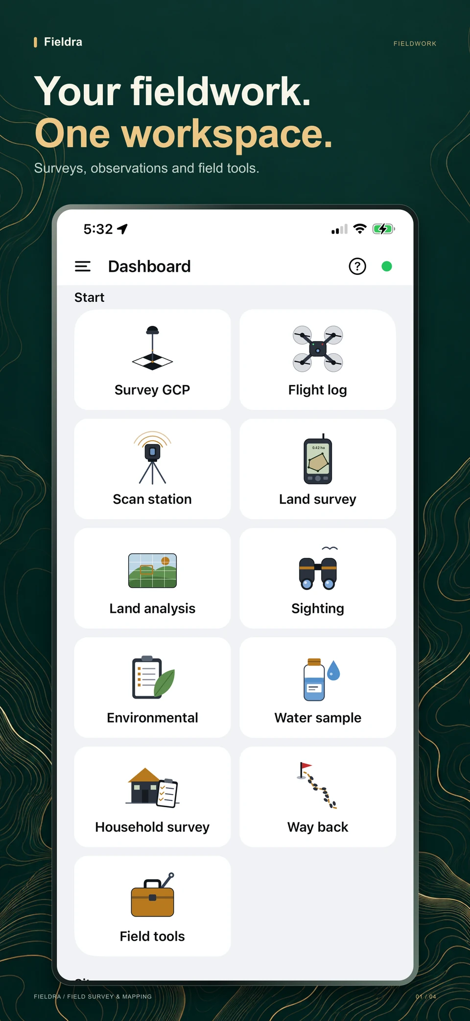
One app for the whole site visit
Open a module from the side menu. Each one fills in the GPS position by itself, takes photos, and saves to the phone. Tap the ? at the top of any module to see how it works.
Terrestrial Survey
Ground control points and checkpoints, stake-out, flight logs with a pre-flight checklist, flight planning for the L3, L1, P1 and Phantom 4, PPK jobs, a checkpoint accuracy report (ASPRS 2023), laser-scanner station logs, and mission areas as KML or CSV.
Environmental Survey
Vegetation, waste, soil, air and noise observations. Pick a category from a list, add photos, and let photo recognition suggest what it shows.
Biodiversity
Quick sightings, point counts, transects and quadrats, with a running species list and diversity scores explained in plain English.
Land & Scene Analysis
Photograph the land and the phone suggests what it is and how much of the picture is trees, grass, soil, water or road.
Compass & Azimuth
A live compass dial with magnetic and true north, pitch and roll. Record bearings with notes and photos.
Qibla
The direction of the Kaaba from where you stand, with a pointer on the compass dial and “turn left / right” guidance.
Socio-economic Survey
Build household questionnaires like KoboToolbox: numbered questions, choices listed as round buttons or tick boxes, skip logic and consent. Answers stay on the phone, export as Kobo-style CSV, and each response shares as a PDF. Print the form on paper as a back-up.
Way Back
Mark where you started, drop spots along the way, and get walking directions back when you are lost, online or offline.
Land Survey
Survey a plot with the phone’s compass and any tape or rule: walk the boundary beacon to beacon while a line guide keeps the tape on line. Back bearings catch compass errors; Fieldra gives the closure, adjusts the corners, works out the area and makes a survey report.
Road Survey
Drive a road to record its line, and mark potholes, cracks and blocked drains along the way. The line keeps recording with the screen off.
Water Survey
Sampling points, scanned bottle labels, and readings from Bluetooth water meters that fill in the form by themselves.
Field Tools
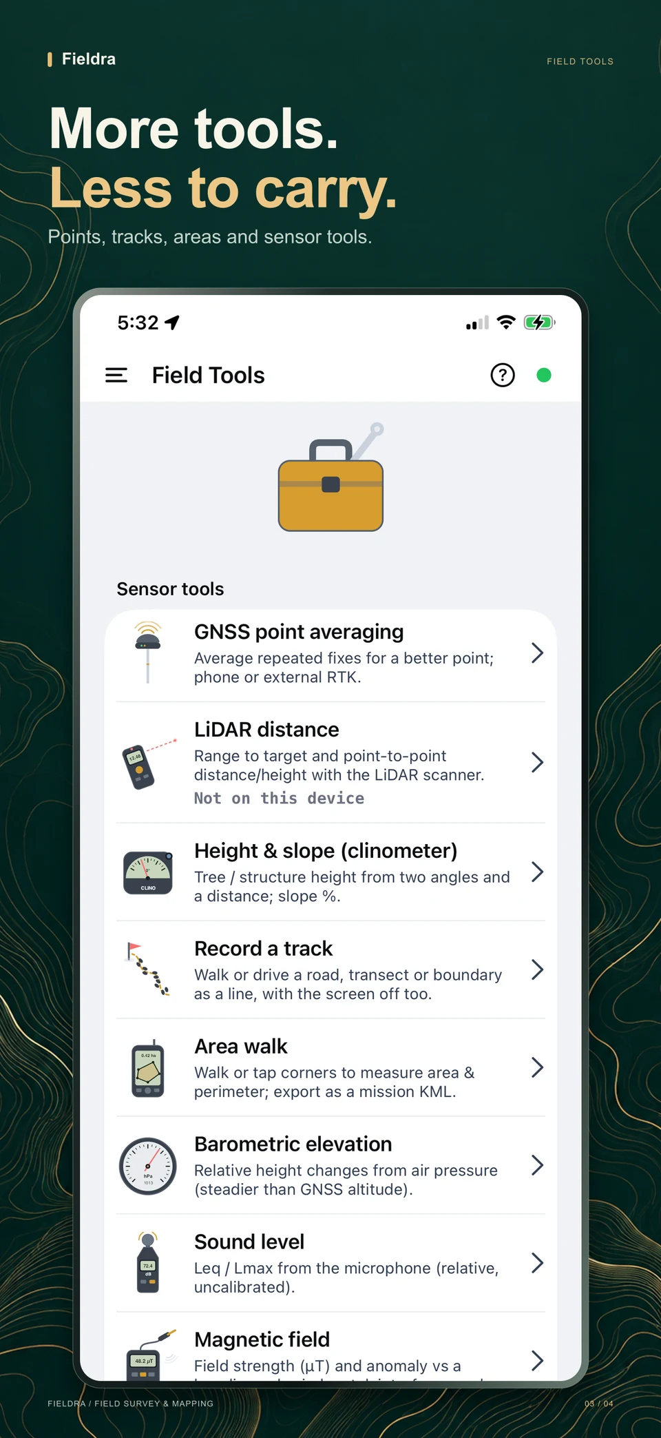
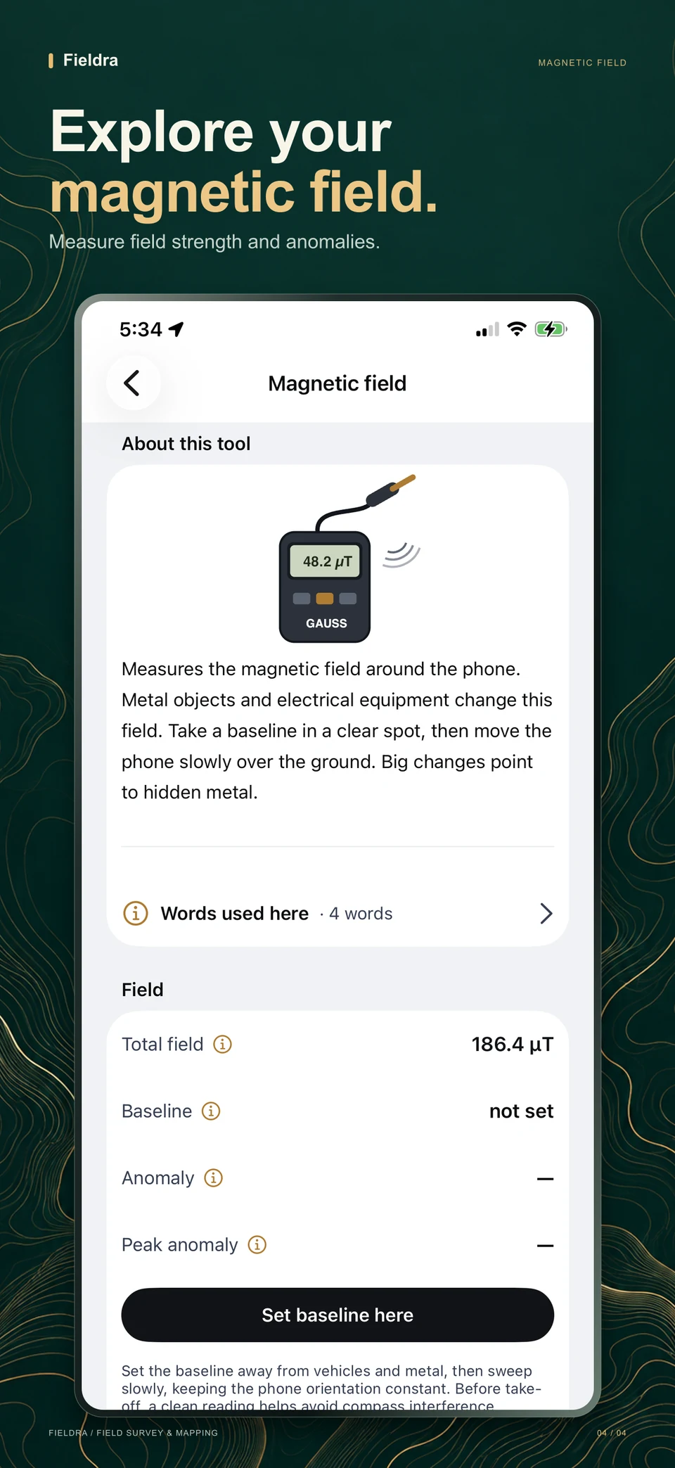
GNSS averaging, LiDAR distance on iPhone Pro, tree and building height, area walk, barometric height, sound level, magnetic anomaly and a label scanner. Each tool explains itself with a drawing of the real instrument.
Survey plans
Draw the study area and the points to visit for each module, with unique plan names. Tap a planned point for walking directions to it.
Photo Gallery
Every photo in the project, organised by category. Swipe through them full screen, open the record, share, save or remove.
Nearby Devices
A radar shows the phones and computers with Fieldra around you, by name. Send a whole project, or just part of it, over Wi-Fi, deletions and office layers included; an interrupted transfer continues where it stopped.
Map, Records & Export
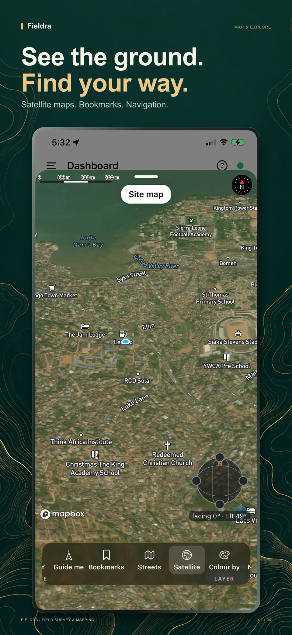
See everything on a map with tools in one bar like Fieldra Desktop’s: tick layers on and off (office layers too), go to a coordinate, switch to satellite, and put the map on an A4, A3 or Letter page with a legend, north arrow and scale bar as a PDF or image. Browse every record, export or sync the project, and navigate on your own orthomosaic (MBTiles from DJI Terra or Pix4D) with no signal.
Made for the field
Big targets for gloves, plain words for people who are not surveyors, and nothing that needs signal.
Help on every screen
A ? button in each module opens how it works: what it is for, the steps, and tips.
Words explained
Technical words carry a small ⓘ. Tap it and one sheet explains them all in simple English.
Choices in a bottom sheet
Categories, methods and settings open in a sheet with a line under each option, sized for a thumb.
Online or offline at a glance
A green or grey dot in the corner. Tap it to see what is waiting to upload and what to do.
Clear confirmations
“Observation saved”, “Export ready”: short messages confirm each step, and questions come as clear dialogs.
Drawings of the real kit
Every tool and start option shows the instrument it stands in for, from the RTK rover to the sound meter.
From the field to the office
- 1
Record on site
Every record gets its position, its accuracy, the time and your photos.
- 2
Saved on the phone
Nothing needs signal. A dot in the corner shows online or offline; records wait on the phone until you are back.
- 3
Send to the office
On the office Wi-Fi, the phone sends everything to Fieldra Desktop: records, form answers and photos, no internet needed.
- 4
Export the project
GCP files for DJI Terra, Pix4D and Metashape, plus GeoJSON, KML, a ZIP with every photo, and CSV that keeps lines and areas as shapes.
- 5
Process in the office
Map and check it in Fieldra Desktop, open the drone’s point cloud and orthomosaic next to it, and grade the accuracy. Or open the files in ArcGIS Pro, DJI Terra, QGIS or Excel.
New · for macOS and Windows
Fieldra Desktop
The office side of Fieldra. Phones send projects over Wi-Fi; the desktop maps them offline, edits and analyses them, prints layouts, reports survey forms as PDF or Word, and saves files ArcGIS Pro opens. For drone work it shows point clouds and orthomosaics, checks a flight’s photos before processing, and grades the model with your checkpoints.
Get Fieldra DesktopApple silicon and Intel Macs · Windows x64, ARM64 and 32-bit
Works with the equipment you use
Common DJI aircraft, payloads and correction options come preset, so the numbers on site match what DJI Pilot 2 and DJI Terra expect. Other drones, GNSS receivers and scanners work with everything else: targets, stake-out, flight logs, scan stations and exports.
| Equipment | In Fieldra |
|---|---|
| Matrice 400 with Zenmuse L3 or P1 | Flight calculator with the L3 pulse rates, flight log, D-RTK 3 corrections |
| Matrice 300 RTK with Zenmuse L1 or P1 | Flight calculator, flight log, D-RTK 3 corrections |
| Phantom 4 RTK and Phantom 4 Pro | Flight calculator for the built-in camera; reminders to lay GCPs when there is no RTK |
| D-RTK 3 (rover mode) | Import the points you measured in the DJI Enterprise app, then add photos and notes |
| Bluetooth LE RTK receivers | Stream NMEA straight into Fieldra; it averages the readings and keeps the fix quality |
| Classic Bluetooth and MFi receivers | Connect through the phone’s location (Android mock location, iOS MFi); Fieldra records the RTK accuracy |
| Bluetooth water meters | pH, temperature, turbidity and conductivity fill in the sample form automatically |
| DJI Terra, Pix4D, Metashape | Ready-made GCP and checkpoint files; on Fieldra Desktop, open their point clouds and orthomosaics and grade the model against your checkpoints (ASPRS 2023) |
| PPK (D-RTK 3 or other base) | A PPK job per flight: base point, antenna height, logging times, the raw files and the processing result |
| Terrestrial laser scanner | Station log, visible targets and target coordinates in UTM |
Download Fieldra
Install it on the phone you take to site. After the first setup it works without internet, so install it and download the AI models while you are on Wi-Fi.
On a computer? Scan this with your phone to open this page there.
Android
Coming soon to Google Play. The button will open the store as soon as the app is approved.
- 1Open this page on your phone and tap the Google Play button.
- 2Tap Install.
- 3Open Fieldra and create your first project.
iPhone and iPad
Coming soon to the App Store. The button will open the store as soon as the app is approved.
- 1Open this page on your phone and tap the App Store button.
- 2Tap Install.
- 3Open Fieldra and create your first project.
See Fieldra in action
Your workspace, maps and tools, ready for the field.
Swipe to explore. Open any screenshot for a closer look.
Fieldra Desktop for the office
On the Mac App Store and the Microsoft Store (recommended), or as a direct download. Receives projects from phones over Wi-Fi.
Guides
Read them online or download them to keep on your phone or computer.
For field teams and office staff
Complete guide
How to use the phone app, Fieldra Desktop and drone mapping, step by step in plain words, with pictures.
PDF · 84 pages · Updated 16 October 2026
For developers and technical teams
Technical guide
Architecture, processing engines, data storage, recovery behavior and measured performance limits.
PDF · 35 pages · Updated 16 October 2026
For testers and project leads
Test script
Step-by-step checks with expected results, including interrupted processing, retries and large datasets.
PDF · 63 pages · Updated 16 October 2026
For teams choosing their workflow
Capabilities and limitations
A feature comparison with ArcGIS and QGIS, with current gaps and limits to help plan project work.
PDF · 28 pages · Updated 16 October 2026